
We should reach the low to mid 70’s today with windy conditions and the chance of scattered thunderstorms. A line of storms has set up to our west as of 5 o’clock this morning.
Isolated strong to severe storms are possible in 2 waves Thursday. Between 5-9am, a line of showers and storms will cross the area. After that, isolated storms will be possible with a strong cold front passage across far eastern VA and lower MD from Noon to 4 pm. #vawx #mdwx pic.twitter.com/sBVzzOb9A4
— NWS Wakefield (@NWSWakefieldVA) April 9, 2020
The winds and storms are a sign that tomorrow will be much cooler, with partly cloudy and windy conditions and temps approaching 55 degrees.
On the pandemic front the daily death toll continues to mount. Notice that the highest daily death total worldwide was just two days ago.

There are, however, subtle signs that the social distancing measures that people all over the world are taking is beginning to flatten the curve. The table below contains weekly data that I have personally collected over the past 11 weeks.
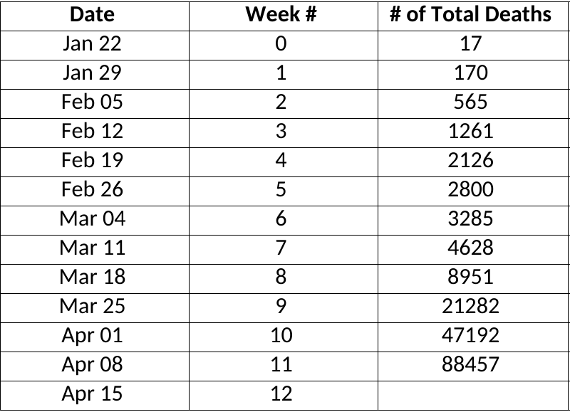
What number of fatalities should you expect to see this time next week that would convince you that a return to normalcy is near?
OFFICIAL SALISBURY WEATHER FORECAST